Where is the Northern Rivers?
Over 20,000 square metres Northern Rivers offers a unique blend of coastal charm and inland beauty, providing residents and visitors with a wide range of natural landscapes to explore and enjoy. Located in the eastern part of Australia, the Northern Rivers region sits in the northeastern corner of New South Wales (NSW), bordering the state of Queensland.
It stretches along the coastline from the city of Grafton in the south, to Tweed Heads in the north, encompassing a diverse landscape that extends inland to the Kyogle council area.
The Northern Rivers is approximately 730 kilometers north of our state’s capital city Sydney and shares a border with Queensland, making it a gateway to the northern states of Australia. The Queensland border runs along the northern boundary of the region.
80+ Beaches
100+ National Parks
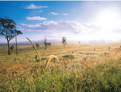
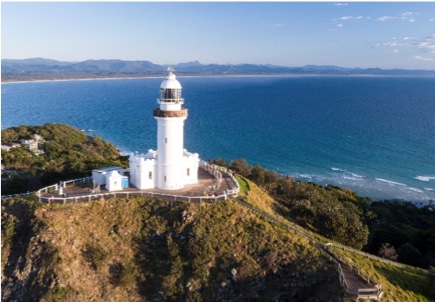
The Northern Rivers region boasts significant geographic diversity. Along the coast, you'll find stunning beaches, pristine coastal lakes, and vibrant seaside towns. The coastline is known for its scenic beauty, surf breaks, and popular tourist destinations like Byron Bay.
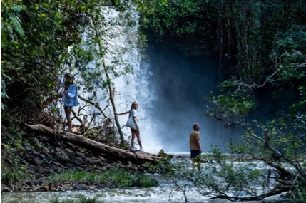
As you move westward from the coast, the landscape gradually transitions into lush hinterlands, rolling hills, and fertile river valleys. This inland region is characterized by subtropical rainforests, cascading waterfalls, and abundant wildlife.
Who lives in the Northern Rivers?
Stats on population
Population
(2022)
of Working Age
(15y-64y)
Median Income
Family
Households
Couple families
(no children)
Lone Person
Households
| Local Government Area | Population | Family Households | Couple Families (no kids) |
Lone Person household | Median Income |
| Tweed | 97718 | 25436 | 11692 | 10812 | 42631 |
| Clarence | 54580 | 14188 | 7172 | 6054 | 40722 |
| Ballina | 46760 | 12451 | 5890 | 5155 | 43873 |
| Lismore | 44202 | 11150 | 4668 | 5212 | 43382 |
| Byron | 36398 | 8297 | 3609 | 3439 | 36573 |
| Richmond | 23671 | 5989 | 2770 | 2578 | 43233 |
| Kyogle | 9418 | 2405 | 256 | 1208 | 33609 |
Where do people live?
Clarence Valley
Clarence Valley encompasses approximately 10,441 square kilometers. It is known for the mighty Clarence River and its tributaries (Mann, Nymboida and Orara Rivers) that flow through coastal floodplains to Yamba where it meets the Pacific Ocean. The council area covers various towns and suburbs, including Grafton, Maclean, Yamba, and Iluka. With a population of over 50,000 residents, the Clarence Valley is home to some major industries including commercial estuary and ocean fisheries and is also the location of a large correctional centre. (Photo Credit: Destination NSW)
Read more about real estate and housing in the Clarence Valley - Real Estate & Housing page
Richmond Valley
Richmond Valley spans an area of around 3,051 square kilometers and is home to diverse landscapes, including coastal areas, fertile farmland, and picturesque river valleys. The council covers towns such as Casino, Evans Head, and Coraki. With a population of approximately 23,000 people, the Richmond Valley region includes a major agricultural industry such as sugar milling, dairy and beef. It is the home of Primex the innovative primary industry exhibition.
Read more about real estate and housing in the Richmond Valley - Real Estate & Housing page
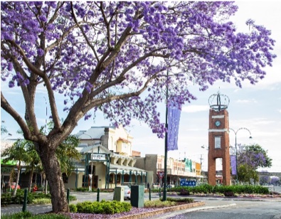
Lismore City
Lismore City covers an area of around 1,280 square kilometers. It is known for its vibrant community and cultural events and the council area encompasses the city of Lismore and surrounding areas, including Goonellabah and Nimbin. With a population of over 45,000 residents, Lismore City is currently home to the largest hospital in the region – the Lismore Base Hospital as well as the only teritiary campus in the region – Southern Cross University. (Photo Credit: Destination NSW)
Read more about real estate and housing in Lismore - Real Estate & Housing page
Kyogle
Kyogle extends over approximately 3,585 square kilometers and is renowned for its stunning natural landscapes and rural charm. The council area covers towns such as Kyogle, Woodenbong, and Bonalbo. With a population of around 9,000 people, Kyogle Council focuses on supporting local agriculture, maintaining infrastructure, and preserving the area's unique environment.
Read more about real estate and housing in Kyogle - Real Estate & Housing page
Ballina Shire
Ballina Shire sits on an area of approximately 484 square kilometers, and is known for its pristine beaches, rivers, and coastal villages and some big prawns! The council area covers towns such as Ballina, Lennox Head, and Alstonville. With a population of over 45,000 residents, Ballina shire is known for being a great place for recreational fishing, surfing, cycling and some more active sports such as hang gliding and paragliding. (Photo Credit: Destination NSW – Killen Falls Ballina).
Read more about real estate and housing in the Ballina - Real Estate & Housing page
Byron Shire
Byron Shire covers an area of approximately 566 square kilometers and is renowned for its natural beauty, vibrant arts scene, and alternative lifestyle. The council area includes towns such as Byron Bay, Mullumbimby, Federal and Bangalow. With a population of around 33,000 people, Byron Shire Council focuses on sustainable development, cultural preservation, and tourism promotion. Internationally famous for its friendly surfing, snorkelling and diving conditions, the Byron brand is often an attractive introduction to the Northern Rivers region for many who come to our shores. (Photo Credit: Destination NSW)
Read more about real estate and housing in the Byron - Real Estate & Housing page
Tweed Shire
Tweed Shire Council is a local government area covering an area of around 1,303 square kilometers, it boasts diverse landscapes, including coastal beaches, lush hinterland, and picturesque river valleys. The council covers towns such as Tweed Heads, Murwillumbah, Casuarina, Pottsville and Kingscliff. With a population of over 95,000 residents, the Tweed shire has the highest number of residents in our region. Being a border town, the Tweed has direct access from the busy Gold Coast and presents an opportunity for cross border employment and Northern Rivers lifestyle. (Photo Credit: Destination NSW)
Read more about real estate and housing in the Tweed - Real Estate & Housing page
What do people do for work?
The largest employers in the Northern Rivers are in the Health sector followed by Retail, Education, Education, Hospitality and Construction.
Top Employing Sectors in Northern Rivers Source : REMPLAN Economy Jobs & Business Insights
Follow this link for more insights into Working in the Northern Rivers
To find work in our region Join the talent community at Jobs Northern Rivers
Climate and Weather
26.2°C Annual Mean Max Temp.
13.3°C Annual Mean Min Temp.
1080.3mm Annual Mean Rain
132.6 days Annual Mean Rain
The Northern Rivers region experiences a subtropical climate with mild winters and warm to hot summers. The region's proximity to the coast influences its weather patterns, resulting in relatively high humidity throughout the year.
In terms of rainfall, the Northern Rivers region is known for its lush, green landscapes due to its high average annual rainfall. The region receives a significant amount of precipitation, with the wettest months typically occurring between November and March. During this period, tropical low-pressure systems and east coast lows can bring heavy rainfall and occasional flooding.
Summer (December to February) in the Northern Rivers is characterised by hot and humid conditions. Average temperatures range from 20 to 30 degrees Celsius (68 to 86 degrees Fahrenheit), with occasional heatwaves pushing temperatures higher. Thunderstorms are common during this season, providing relief from the heat and contributing to the region's rainfall.
Autumn (March to May) brings slightly cooler temperatures and more stable weather. Days are generally warm and pleasant, with temperatures ranging from 17 to 27 degrees Celsius (63 to 81 degrees Fahrenheit).
Winter (June to August) in the Northern Rivers is mild, with average temperatures ranging from 9 to 21 degrees Celsius (48 to 70 degrees Fahrenheit). It is the driest season, and although occasional rain showers occur, clear skies and sunny days are common.
Spring (September to November) sees temperatures gradually warming up again. Days become more humid, and rainfall begins to increase as the region transitions into the wetter summer season.
Fire & Floods
Both fire and flood events have shaped the resilience and preparedness of the Northern Rivers community. Local authorities and emergency services work diligently to monitor weather conditions, issue warnings, and coordinate response efforts during these events. Community education programs and preparedness initiatives are also in place to raise awareness and enhance the region's resilience.
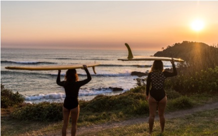
A surfers’ wonderland
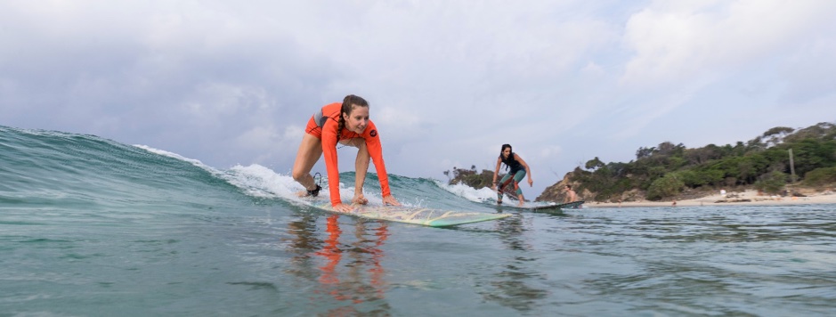
Photo Credit: Destination NSW
The north coast of New South Wales is renowned for its excellent surfing opportunities for beginners and avid surfers. Some well known spots include Byron Bay, Lennox Head, and Yamba. And many others in between.
Byron Bay is a popular surfing destination offering a variety of breaks suitable for surfers of all levels. It experiences consistent swells throughout the year, making it an excellent spot for year-round surfing.
Lennox Head: Located just south of Byron Bay, Lennox Head is known for its world-class right-hand point break called "Lennox Point." This break is renowned for its long rides and is favored by experienced surfers. It tends to work best during larger swells and is often crowded due to its popularity.
Yamba: Yamba offers a variety of surf breaks suitable for all levels. The main break, known as "Turners Beach," is a sand-bottom beach break that works best on mid to high tides. The nearby Angourie Point is a renowned right-hand point break that provides excellent waves for experienced surfers.
Indigenous Connections
The Northern Rivers sits primarily across the Bandjalung nation as well as parts of the Gumbaynggirr and Yaegl nations in the south. Some of the peoples of these nations are acknowledged below:
The Bundjalung Nation is one of the largest Indigenous nations in Australia and encompasses a vast area along the New South Wales coast. All of the local government areas in the Northern Rivers form part of the traditional lands of the Bundjalung people.
Arakwal People: The Arakwal People are a sub-group of the Bundjalung Nation and have strong ties to the Byron and Ballina Shires. They are the traditional custodians of the land encompassing Byron Bay, Broken Head, and parts of the surrounding area. The Arakwal Aboriginal Corporation represents and advocates for the rights and interests of the Arakwal People.
Nyangbul people: The Nyangbul people are a sub-group of the wider Bundjalung Nation. They are the traditional custodians of the land in the area around Evans Head and the coastal regions along the Richmond River and its estuaries.
Gumbaynggirr People: The Gumbaynggirr People are the traditional owners of the land around Nymboida and the upper Clarence River area. They have a strong cultural presence and continue to maintain their connection to the land and their cultural traditions.
Yaegl People: The Yaegl People are the traditional custodians of the land around the lower Clarence River and Yamba area as well as along the lower reaches of the Richmond River. They have a deep connection to the land, waterways, and cultural heritage of the region.
Minjungbal People: The Minjungbal People are the traditional custodians of the land in the Tweed area. They have a deep cultural connection to the region around Tweed Heads and the Tweed River. The Minjungbal Aboriginal Cultural Centre represents and promotes the cultural heritage of the Minjungbal People.
Gidabal People: The Gidabal People are one of the Indigenous groups within the Bundjalung Nation. They have historical connections to the Richmond Valley Council area, particularly around the town of Casino, its surrounding regions and the Kyogle area. The Casino Boolangle Local Aboriginal Land Council represents the local Aboriginal community in the Casino and Kyogle areas. They play an important role in promoting and preserving the cultural heritage and rights of Aboriginal people in the Kyogle area.
Widjabul/Wiyabal People: The Widjabul/Wiyabal People are a sub-group of the Bundjalung Nation and have strong ties to the Lismore area. They are the traditional custodians of the land encompassing Lismore and its surroundings, and their cultural heritage remains an integral part of the region.
Yugambeh People: While primarily associated with the Gold Coast area in Queensland, the Yugambeh People also have historical connections to parts of the Tweed area. They are part of the wider Bundjalung language group and have cultural ties to the broader region.